Abstract
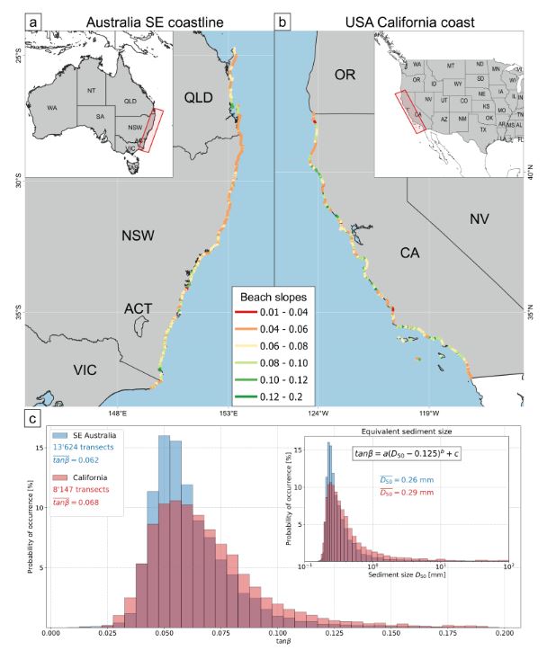
The steepness of the beach face is a fundamental parameter for coastal morphodynamic research. Despite its importance, it remains extremely difficult to obtain reliable estimates of the beach‐face slope over large spatial scales (1000’s of km of coastline). In this letter, a novel approach to estimate this slope from time‐series of satellite‐derived shoreline positions is presented. This new technique uses a frequency‐domain analysis to find the optimum slope that minimises high‐frequency tidal fluctuations relative to lower‐frequency erosion/accretion signals. A detailed assessment of this new approach at 8 locations spanning a range of tidal regimes, wave climates and sediment grain sizes shows strong agreement (R2 = 0.93) with field measurements. The automated technique is then applied across 1000’s of beaches in Eastern Australia and California USA, revealing similar regional‐scale distributions along these two contrasting coastlines and highlights the potential for new global‐scale insight to beach‐face slope spatial distribution, variability and trends.
Kilian Vos
Earth Observation Scientist
Research interests include Earth Observation, machine learning, coastal and water resources engineering.