CoastSat: A Google Earth Engine-enabled Python toolkit to extract shorelines from publicly available satellite imagery
Abstract
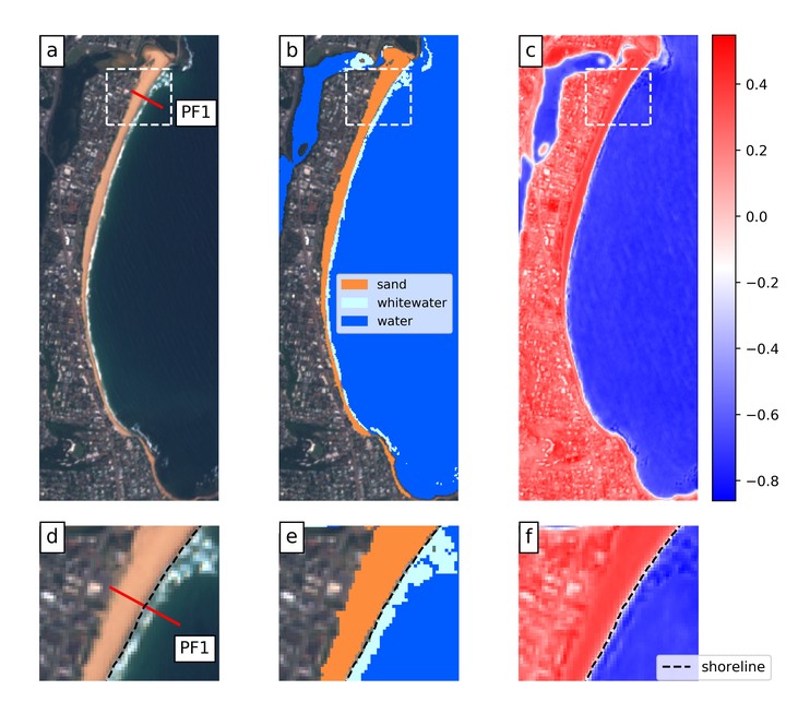
CoastSat is an open-source software toolkit written in Python that enables the user to obtain time-series of shoreline position at any sandy coastline worldwide from 30+ years (and growing) of publicly available satellite imagery. The toolkit exploits the capabilities of Google Earth Engine to efficiently retrieve Landsat and Sentinel-2 images cropped to any user-defined region of interest. The resulting images are pre-processed to remove cloudy pixels and enhance spatial resolution, before applying a robust and generic shoreline detection algorithm. This novel shoreline detection technique combines a supervised image classification and a sub-pixel resolution border segmentation to map the position of the shoreline with an accuracy of ~10 m. The purpose of CoastSat is to provide coastal managers, engineers and scientists a user-friendly and practical toolkit to monitor and explore their coastlines. The software is freely-available on GitHub ( https://github.com/kvos/CoastSat) and is accompanied by guided examples (Jupyter Notebook) plus step-by-step README documentation.
Kilian Vos
Earth Observation Scientist
Research interests include Earth Observation, machine learning, coastal and water resources engineering.