Abstract
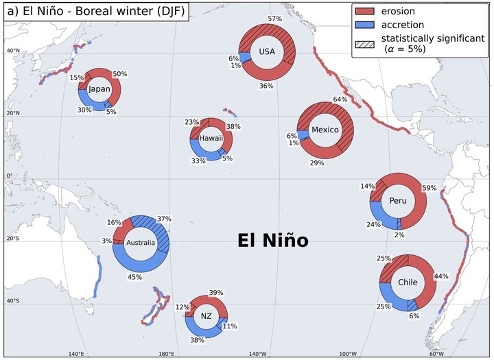
In the Pacific Basin, the El Niño/Southern Oscillation (ENSO) is the dominant mode of interannual climate variability, driving substantial changes in oceanographic forcing and impacting Pacific coastlines. Yet, how sandy coasts respond to these basin-scale changes has to date been limited to a few long-term beach monitoring sites, predominantly on developed coasts. Here we use 38 years of Landsat imagery to map shoreline variability around the Pacific Rim and identify coherent patterns of beach erosion and accretion controlled by ENSO. On the basis of more than 83,000 beach transects covering 8,300 km of sandy coastline, we find that approximately one-third of all transects experience significant erosion during El Niño phases. The Eastern Pacific is particularly vulnerable to widespread erosion, most notably during the large 1997/1998 El Niño event. By contrast, La Niña events coincide with significant accretion for approximately one-quarter of all transects, although substantial erosion is observed in southeast Australia and other localized regions. The observed regional variability in the coastal response to ENSO has important implications for coastal planning and adaptation measures across the Pacific, particularly in light of projected future changes in ENSO amplitude and flavour.
Kilian Vos
Earth Observation Scientist
Research interests include Earth Observation, machine learning, coastal and water resources engineering.